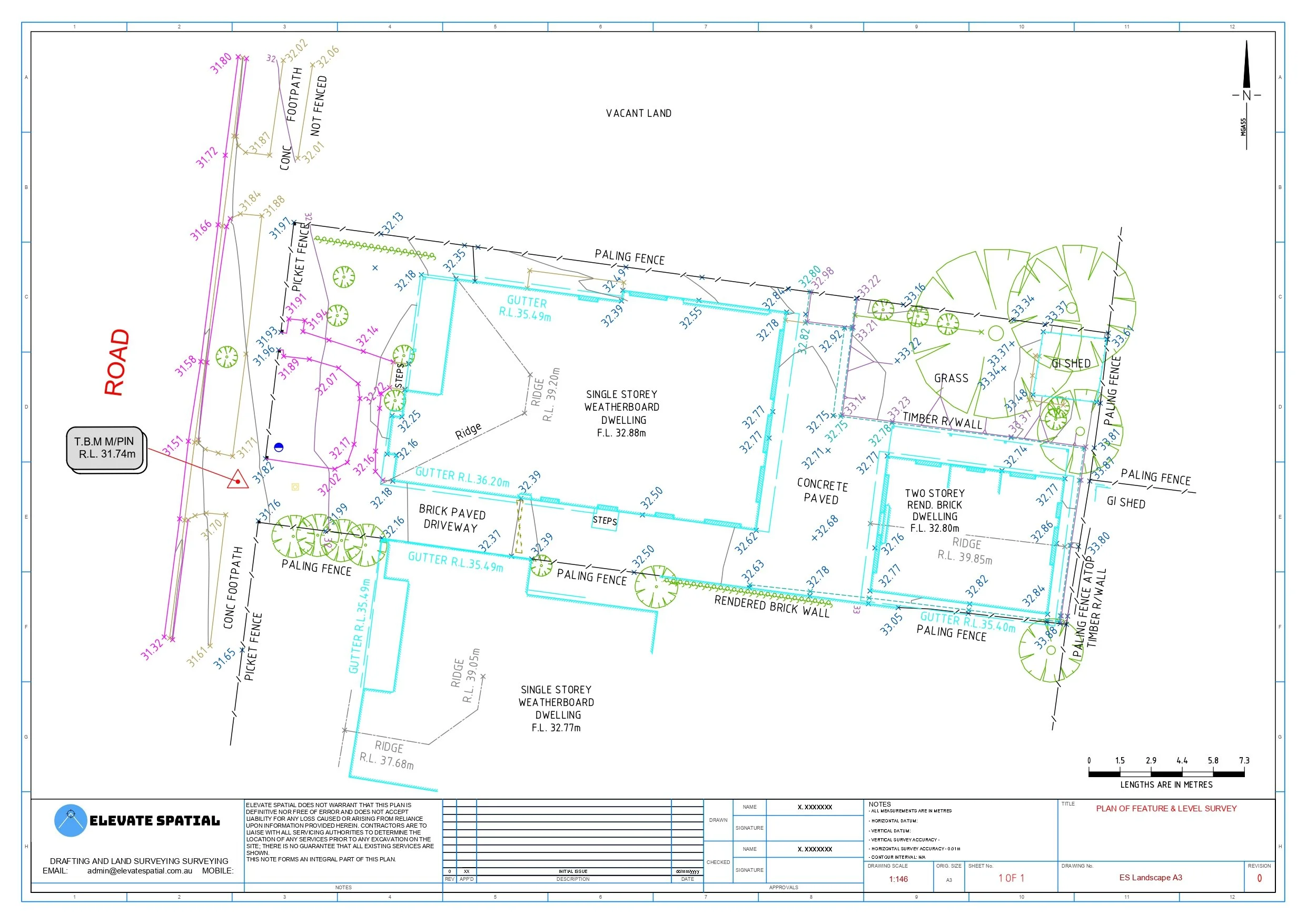
Feature and Level Survey
Topographical map of a site’s feature, levels and structures within the surrounding area, providing crucial information for designers, council and architects to implement development plan.
The information provided in this plan includes:
Ground levels (AHD or Arbitrary) and contours.
Existing and adjoining structures (The position of houses, windows, heights of eaves and ridges of the site).
Utility services.
Any significant vegetation or trees.
Street Context.
Fence locations and preparations for a plan of survey
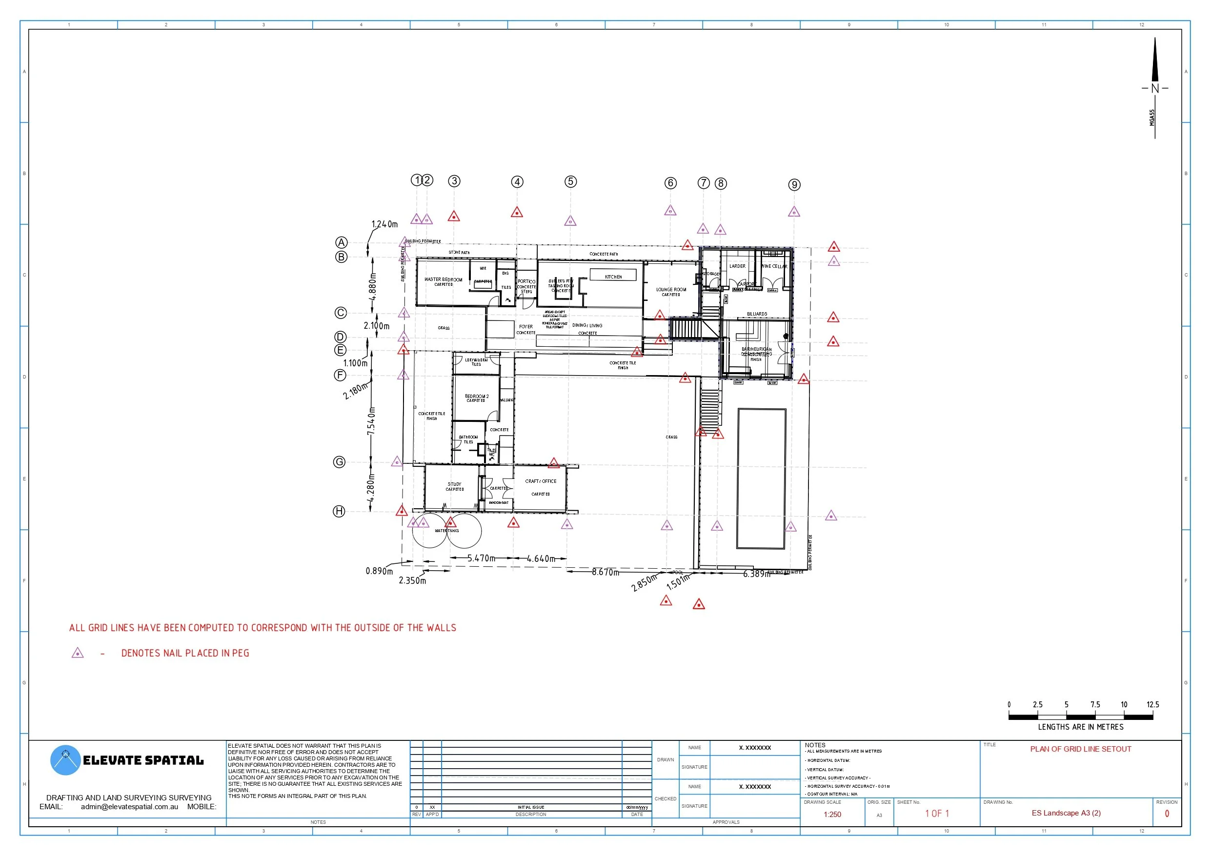
Building Setout
Setting out the position of proposed structures accurately, from new homes and units to infrastructure.
On-site deliverables:
Nails in stakes or fencing is placed to show construction lines on site.
Each line is clearly labelled and colour coded for ease of construction.
The information provided in this plan includes:
Building footprint.
Offsets from boundaries if needed.
Grid lines.
Floor levels.
Key structural points.
As Constructed Survey
A survey which verifies that the construction process was completed as per design specification, and any discrepancies are identified.
The information provided in this plan includes:
Accurate location and dimensions of completed structures.
Finished floor levels, ground levels, and drainage invert levels.
Locations and depths of utilities and service connections.
Variations from approved design for compliance and certification.